The Gift of South Dakota
Subscriptions to South Dakota Magazine make great gifts!
Subscribe today — 1 year (6 issues) is just $29!
Glacial Lakes in Winter
Dec 18, 2020
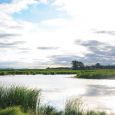
South Dakota's Glacial Lakes country is perfect for day trips this winter. More than a hundred lakes — plus sloughs, wetlands, ponds and rivers — combine to create a scenic and unspoiled countryside rich with wildlife and waterfowl, friendly farm towns and numerous opportunities to enjoy nature.
Melting glaciers shaped this prairie pothole country 20,000 years ago. The lakes are so numerous that some remain unnamed. Most have grown in size and depth over the last 25 years. Bitter Lake, once little more than a shallow slough, is now the state’s largest natural lake; it is encroaching on Waubay Lake and other bodies of water to create an ocean-less, inland sea.
In this winter of the pandemic, we are all looking for new outdoor sights and experiences. Winter serenity and solitude has always been a trademark of the unspoiled Glacial Lakes region.
Here are 10 suggestions, organized by county, on how you might explore the Glacial Lakes. Some are auto drives, others offer winter hikes that could be compromised by the amount of snow on the ground. However, this list only scratches the surface so don’t hesitate to roam the lake country. You’ll discover many surprises, and they’ll all be good.
BROOKINGS COUNTY — The 135-acre Dakota Nature Park (at the corner of 22nd Avenue and 32nd Street South) lies in the southeastern corner of Brookings. Gravel mining led to formation of ponds and wetlands, and a restored prairie now grows atop the old landfill mound. A portion of the Allyn Frerichs Trail System — named for the city’s longtime parks and rec director who passed away in 2014 — skirts the north edge of the park, while a network of paths weave around the wetlands, prairies and trees.
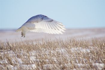
BROWN COUNTY — Take a trip to Sand Lake National Wildlife Refuge. Though the classic 15-mile auto tour is closed in winter due to hunting and snow conditions, other roads remain open on the perimeter of the refuge. Explore the gravel roads that lead north and south from Highway 10. The snow geese are gone, but you’ll see other waterfowl, eagles and the Arctic's snowy owls. Deer, pheasant and coyotes are also common. Sand Lake rose from the dust of the Great Depression to become one of the world’s most important wildlife sanctuaries. It is 30 miles northeast of Aberdeen.
CODINGTON COUNTY — Just southwest of Watertown is Pelican Lake. An observation tower near an inlet on the lake’s south side provides a sweeping view of the water, its namesake birds, the prairie and Watertown’s skyline. The Observation Tower Trail is a three-quarters of a mile hike through the woods and winter grasses. A longer jaunt, the Pelican Prairie Trail, gently meanders 5.2 miles.
DAY COUNTY— Explore the trails of Waubay National Wildlife Refuge, situated in the very heart of the Prairie Pothole landscape. Scientists say the region produces 50 percent of the continent’s waterfowl. Trails range from a few hundred feet to a mile, and jaunt around an island that houses the refuge headquarters. However, the public facilities are closed in winter.
DEUEL COUNTY — Visit 12-acre Ulven Park, which occupies a point on the eastern shore of Clear Lake. The frogs and toads, noisy in summer, are now hibernating so they’ll not interrupt the serenity of the park's half-mile hiking trail.
EDMUNDS COUNTY — Shake Maza Trail at Mina Lake (between Ipswich and Aberdeen) is a short walk that explores the flora, fauna and other features at one of the first man-made lakes in northeast South Dakota. Shake Maza is a Native term meaning “shaped like a horseshoe,” which describes the 850-acre lake, ringed by picturesque cabins and homes.
GRANT COUNTY — This fascinating region is one of the USA’s five continental divides. Lake Traverse flows west to the Hudson Bay and Big Stone Lake flows south to the Mississippi and the Gulf of Mexico. Some of the best winter trails are at Hartford Beach State Park — a tree-filled, rocky shoreline north of Milbank that is quite unlike anything else in the Glacial Lakes. Signage in the park will direct you to several easy trails.
HAND COUNTY — Hike the Pheasant Run Trail at Lake Louise, 14 miles northwest of Miller. Beginning at the trailhead in the main campground, the dirt and grass trail meanders 3.2 miles around the south side of Lake Louise, which was created by damming the south fork of Wolf Creek in 1932. More than three dozen informational plaques identify trees and plants found along the way, though leaf identification will be challenging in December and January.
LAKE COUNTY — Wander the trails of Lake Herman State Park, which occupies a peninsula on the east side of Lake Herman, just west of Madison. A cabin built by pioneer Herman Luce in about 1870 stands along the 1.25-mile Luce Adventure Trail, which encircles Herman Pond. Connecting trails include the Abbott Trail (1.1 miles) and the Pioneer Nature Trail (.4 miles). All are easy walking.
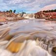
MOODY COUNTY — Much of the prairie pothole region drains into the Big Sioux River, and the waterway starts to change its personality as it reaches Flandreau and Dell Rapids. Hike Red Rock Trail in Dell Rapids, where you can enjoy a closeup view of the famous rose quartzite that underlies the region.





Comments