The Gift of South Dakota
Subscriptions to South Dakota Magazine make great gifts!
Subscribe today — 1 year (6 issues) is just $29!
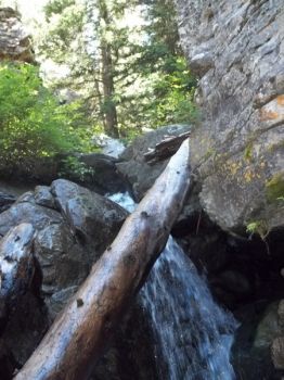
Annie Creek Falls
Aug 23, 2013
Spearfish Canyon has so many secrets hidden back in the canyon walls that you wonder if any one person knows them all. After a summer of exploring, this writer is still discovering. On the way to the Black Hills earlier this month we talked with some friends, Mike and Robin Moran of Watertown, who told us about a pretty place in the canyon called Annie Creek Falls. The next day, while having lunch at the Latchstring in the canyon, we learned that our waitress was a South Dakota native and a student at Black Hills State. The pipeline to knowledge about where to hike in the canyon flows through BHSU, so we asked her what favorite unpublished place she liked. Annie Creek Falls was the first one she named, so our next destination was set.
LEAVE YOUR AUDI AT HOME
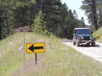
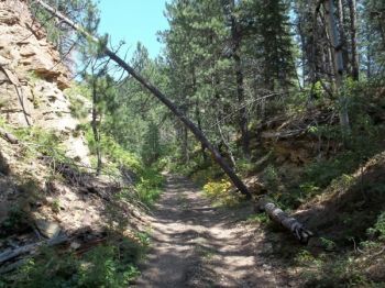
We have an old Jeep Ranger that won’t win a beauty contest anywhere outside of the Ozarks, but it is the vehicle of choice for a trip up Annie Creek Road. The Annie Creek Road sign is the first right past Elmore as you drive north into Spearfish Canyon from Cheyenne Crossing, heading towards Savoy. The road is an old narrow gauge rail bed. As you drive up it you’ll see the remnants of old rail ties, long ago embedded in its floor. Turning around is never an option if you have a full-size vehicle, and is barely an option in a Ranger. The potholes are a definitive test for loose fillings, and there are several times you’ll plow through water holes of indeterminate depths — a free car wash of sorts.
YOU ARE THERE
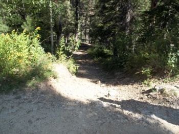
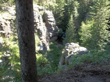
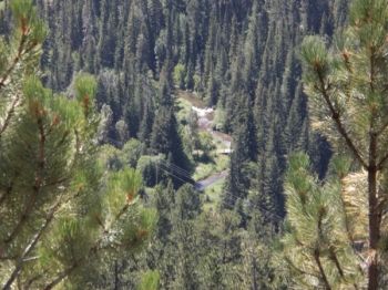
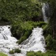
When a spot appears on your right that looks like you can pull over a little, you are there. Across the road, from whence you hear the rushing water, is a trail into the brush — take it. It’s a very short hike to a landing that looks over the canyon below and the water falls to your right. But, the fun doesn’t end there — the adventure has just begun.
To get down to the falls you have three choices. First, you could jump. If you pick that option, don’t bother wasting time snapping a quick photo on the way down — a quick prayer would be more useful. Either of the other two options is marginally safer. To the left you can make short switchback-like cuts as you climb and work your way to the bottom. Be careful — it is treacherous. The left path brings you about fifty yards below the falls. The hike up the creek affords more beautiful views of the area. The option to the right is one we didn’t even see on the way down. This is the shorter and maybe safer route, but it is crawling from handhold (tree root) to handhold (rock ledge) all the way down. The right side route brings you out near the base of the falls — and is clearly the easier route for the hike back up.
IT’S BEAUTIFUL DOWN THERE
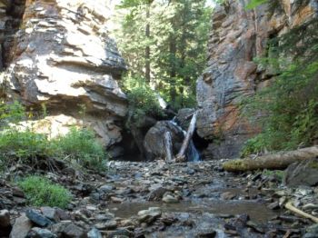
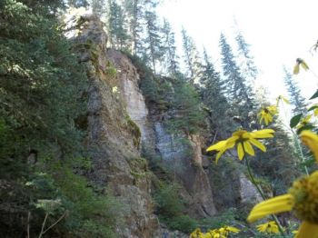
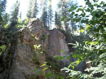
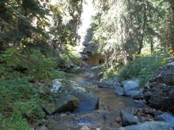
The path to the bottom probably deters most, and from a safety perspective, that may be a good thing. But if you are one of those hardy souls that can navigate the way down, the pretty and peaceful creek bottom at the base of Annie Creek Falls is worth the hike. This is the kind of place where people would want to take wedding photos, if they could figure out how to get all the gowns down there in their original color and condition.
ANNIE CREEK HAS MORE TO OFFER
The old trail is also the route used by 4-wheelers between Terry Peak and Cheyenne Crossing. A Minnesota group, whose leaders hailed from De Smet, stopped at the falls while we were there. After exchanging the traditional South Dakota greeting: “Where are you from?” followed by “Do you know __?” we discerned that the leader was a cousin of friends of ours from Watertown, and they knew my law school classmate from De Smet, Todd Wilkinson. In South Dakota speak, we had bonded. The 4-wheelers explained to us that there was more to see by travelling further up Annie Creek Road, so the adventure continued.
About a half mile further up the road (where road speeds are about 8 mph on a good stretch), you cross the creek. The road bed has been built up well above the creek, and presumably there’s a big culvert in the brush below, but the driver is well advised to adhere to the biblical directive of staying focused on the narrow path ahead. When you’ve crossed the creek, the “road” ends — but the adventure doesn’t. To the right is a strictly 4-wheeler route to Terry Peak. To the left there are two paths. We took the high road, which is a continuation of the narrow rail bed.
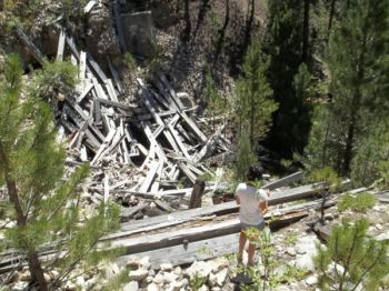
If you hike for about a mile, you’ll come to first one, then another, former railroad trestles. The trestles have been felled, probably to avoid hikers using them to cross the gullies they forded. To get to the second former trestle, you of course need to be crazy enough to hike down, through and up the first trestle gorge. This would be a good point to suggest another whole set of safety disclaimers. But if you have the endurance and lack of good judgment for the trip, it’s a pretty view and a neat crawl through the remnants of Black Hills railroad history.
There’s some “treasure” to be found on the more remote sections of the rail bed, as we learned from a family we met near the first gorge. We came up on a father, mother and son digging in the dirt along the remote rail bed — not exactly everyday behavior. It piqued our curiosity. We learned that they were using metal detectors and shovels to unearth the spikes that had been discarded when the rail lines were pulled up years before. They said that you could even find the old spikes lying on the ground sometimes along the route. My very curious wife, after navigating there and back through two gorges, couldn’t resist digging in the shallow dirt along the trail in several places looking for the hidden treasure — but alas, to no avail.
TAKEAWAYS AND TREASURES
The hidden gems to hike to in the Hills are worth the time and effort. We hope others will tell us of more of these to explore. Also, the rich railroad history of the Black Hills would be fascinating to explore, if a knowledgeable guide would surface.
Finally, the treasures of the Hills really are there for the taking. On the walk back along the old rail bed, with one of my wife’s steps on the trail came a metallic “clink” sound. There, just waiting to be picked from the ground by the adventurous, was a rail spike — a Black Hills treasure to the memory of Annie Creek.
Lee Schoenbeck grew up in Webster, practices law in Watertown, and is a freelance writer for the South Dakota Magazine website.







Comments
- Annie Creek road is about 3.8 miles from Spearfish Canyon Lodge.
- We chose to leave our car down by the Canyon road. The creek road has many large, sharp rocks about fist sized. I didn't want to risk a tire puncture.
- The trailhead is almost exactly a mile from the main road. The trailhead is not marked, but easy to find. From the road you begin to descend immediately towards the creek.
- Half way down you have to scale down a sheer rock wall, not very high though. There are plenty of hand/foot holds to help. One person thoughtfully left a rope tied off at the top and dangling down to add to safety. Climbing back up is hand over hand.
- The whole hike from trailhead to falls is only about 100 yards, and well worth it.
Our small group loved this hike. Definitely a must if you are up for some adventure!