The Gift of South Dakota
Subscriptions to South Dakota Magazine make great gifts!
Subscribe today — 1 year (6 issues) is just $29!
Eight Over Seven … In One
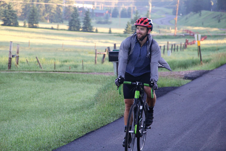 |
| Rapid City's Erick Sykora biked, hiked and ran up the Black Hills' eight tallest peaks in a single day. |
Black Hills adventurers sensed a challenge in the summer of 2017, when Seth Tupper published a series of articles called “Eight over Seven,” which featured the eight mountains in the Black Hills that stand 7,000 feet or taller. Hikers, bikers and runners set out to conquer each one. Many of them blogged about their adventures through the summer and fall.
Erick Sykora considered it a bit more ambitiously. “I looked at where these were placed and started thinking maybe you could do it in a day,” he says.
Only one other group of hikers is known to have accomplished the feat, traveling from peak to peak by car. Sykora wanted to use nothing but his own manpower. The prospect might intimidate many a day hiker, but Sykora is an avid cyclist and runner with several triathlons, half marathons and mountain bike races under his belt. Still, many factors — including weather, health, access to food and water — would have to fall into place. And, as it turned out, he’d need a little luck.
Sykora began studying U.S. Forest Service maps as well as Google maps and smartphone apps to set his best course of action. He decided on a path that followed roughly a crescent shape through the central Hills beginning at Terry Peak southwest of Lead and proceeding to Crooks Tower, Crows Nest Peak, Green Mountain, Odakota Mountain, Bear Mountain and Sylvan Peak before ending at Black Elk Peak, the tallest point in South Dakota. “I knew I was going to go north to south just because the elevation gain made more sense to do it that way,” he says. “Only a few, like Bear Mountain and Odakota Mountain, did I have to really think about because there aren’t a lot of roads through there. But you can kind of connect the dots if you look at it on a map, so I figured that would be the best way to do it.”
With a route in place, he focused on each peak. He created a spreadsheet that planned every mile and every minute. He identified the best spots to begin his ascent and how far he’d be able to ride his bike before ditching it in the woods for his running shoes and picking it up again on the way down. There were also notes for his parents, Barry and Sonia, who followed in their pickup with food, water and any other support Sykora might need.
So after almost eight months of planning, Sykora, who works as a lumber broker for Forest Products Distributors in Rapid City, arrived at the base of Terry Peak at 5 a.m. on the morning of July 7, 2018. Roughly 15 hours later, he finished the remarkable journey with a sandwich and a cold beer at the base of Black Elk Peak. He’d bicycled about 100 miles (both in ascending or descending several of the mountains and over the road traveling from peak to peak) and hiked or run about 15 miles. “There was just this huge sense of accomplishment,” Sykora says. “We sort of sat around and reflected on the day. I was happy for my mom and dad too, because they’d gotten to go into really remote places and see things that not many people get to see. There was no point during the day where something happened and I thought, ‘This is not good.’ It all ran smoothly. We felt really good.”
Here are the Black Hills’ “Eight Over Seven,” in the order in which Sykora climbed each one, and some observations from his journey.
 |
Terry Peak
7,064 feet
Lawrence County
6 miles southwest of Lead
Most South Dakotans know Terry Peak as one of the prime skiing locations in the state. Members of the Bald Mountain Ski Club set out to make it so in 1938, when they installed a rope tow up Stewart Slope on land donated by Bertha Stewart. Today Terry Peak boasts more than 25 trails and 600 skiable acres. Before that, the mountain had been named for Alfred Howe Terry, a Union general during the Civil War and military commander of Dakota Territory from 1866 to 1869 and again from 1872 to 1886.
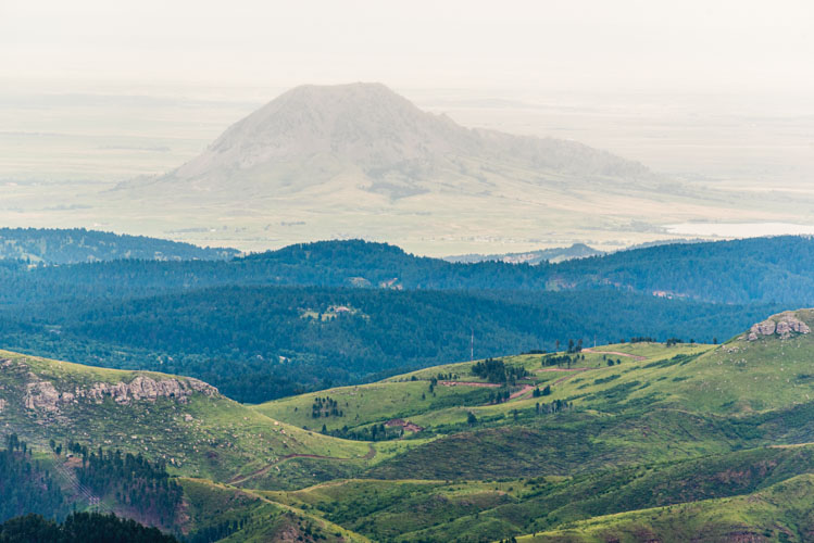
Terry Peak was one of two mountains (along with Black Elk Peak) that Sykora had previously climbed, so he had an idea what to expect. He knew the only bikeable portion would be the descent, so he threw his two-wheeler over his shoulder and followed the chair lift up Stewart Slope to the summit, which affords a vast view of the Hills to the south and, to the west, Spearfish Canyon, where low, early morning clouds had seeped into the valley. “It almost looked like someone had poured milk into Spearfish Canyon,” he says. “It was really cool.”
 |
Crooks Tower
7,137 feet
Lawrence County
17 miles northwest of Rochford
Sykora pedaled the 28 miles to Crooks Tower along the Mickelson Trail and a network of local roads. The path to the top was too rugged for biking, so he ran up and down.
The name Crooks Tower is a misnomer since no tower actually exists at the top. It’s the highest spot in Lawrence County, and for a brief period was thought to be the highest point in the Black Hills. In the spring and summer of 1875, Lt. Col. Richard Irving Dodge escorted Walter P. Jenney as the geologist investigated rumors that Gen. George Armstrong Custer had discovered gold in the Black Hills in 1874. Dodge and his men ascended the great limestone plateau and named it Crook’s Mountain in honor of Gen. George Crook, a former Civil War soldier then serving as head of the Department of the Platte with headquarters at Fort Omaha. Crook is perhaps most well-known in South Dakota history as the commander of U.S. forces at the Battle of Slim Buttes in September of 1876.
Dodge estimated Crook’s Mountain at 7,600 feet, 160 feet taller than Harney (now Black Elk) Peak. Four years later, another published report indicated that Harney was actually the tallest and Crook’s Mountain was second. Today, it comes in fifth.
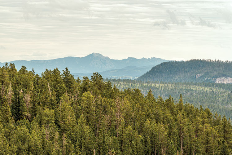
Because there is no distinguishing promontory, the summit can be tough to find. There is a cairn (a pile of rocks that hikers often build to indicate the summit) situated on a ledge, but the true peak lies just beyond that. “That was probably one of the cooler places,” Sykora says. “It was still early in the morning and we saw elk."
 |
Crows Nest Peak
7,048 feet
Pennington County
8 miles northwest of Deerfield
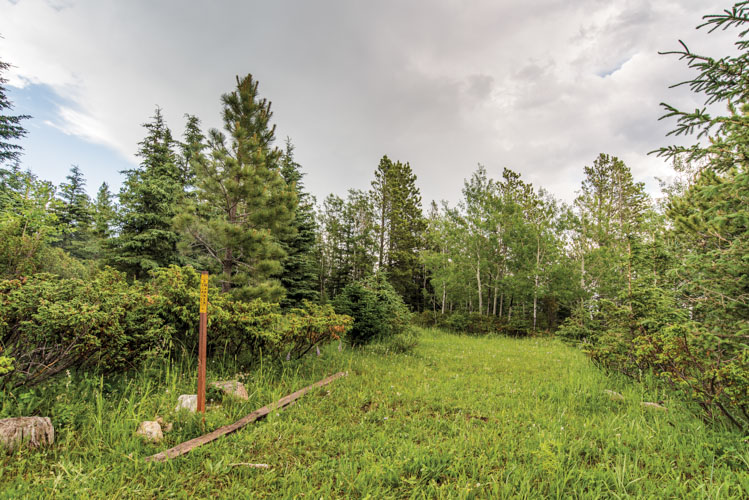
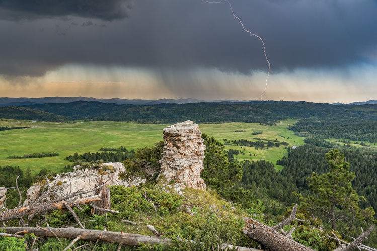
Finding the summit at Crows Nest Peak proved to be the most challenging. After approaching the secluded mountain by bicycle on a gravel road Sykora discovered no trail, so his ascent was a mix of hiking and running through grass and trees toward a hill that he believed to be the top. But as he got closer, he realized he was wrong. “I ended up going off the backside of it and found something that looked a little higher than the last mound. I was kind of giving up, but then I remembered Seth Tupper’s stories from the Rapid City Journal that talked about following a fence line, and I came across the geographical survey marker at the top. So I had a little bit of luck on my side in finding that. Standing on top, I couldn’t see at all. I was in the middle of a forest.”
Legend says the mountain’s name can be traced to a band of Crow Indians who were camped on the summit when a warring tribe established attack lines on three sides. The fourth side proved too rugged for the Crows to escape or the opposing tribe to attack. In the darkness of night, the Crows killed their horses and fashioned ropes from the horse hide, which they used to scale down the fourth side.
 |
Green Mountain
7,164 feet
Pennington County
16 miles northwest of Custer
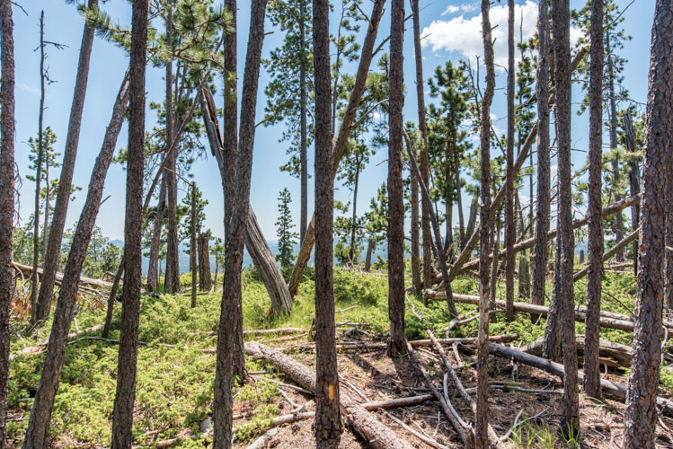
Green Mountain is a favorite destination for snowmobilers, who follow a trail to the summit to a spot called the Clinton Overlook. This path allowed Sykora to bike all the way to the top, which is nothing more than a knob in a limestone ridge. “This one sat out on top of a cliff line and had really cool views. You could see pretty much everything looking to the east.”
Green Mountain was nameless until 1982, when the Black Hills National Forest petitioned the U.S. Board of Geographic Names to call it Green Mountain. Wayne and Lewis Compton, both U.S. Forest Service employees who had lived in the area for nearly 50 years, reported that the peak had always been known locally as Green Mountain simply because it’s largely covered in grass.
 |
Odakota Mountain
7,206 feet
Pennington County
9 miles west of Hill City
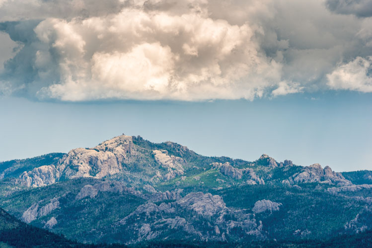
Sykora got a good look at Odakota Mountain, the second highest spot in the Black Hills, because it rises just on the other side of Six Mile Road across from Green Mountain. He bicycled along Long Draw Road, but scrambled the last half mile or so to the top. The summit is marked with a 3 1/4-inch aluminum disk affixed to a 30-inch long iron pipe and set in a 10-inch concrete pad. Jerry Penry, a licensed surveyor in Nebraska and South Dakota, and Black Hills historian and photographer Paul Horsted placed the marker in the summer of 2019 after conducting what they believe to be the first precise survey ever done of Odakota. According to their calculations, Odakota actually stands 7,198 feet tall.
In May of 1968, Harold and Loretta Bradfelt bought a ranch in the Black Hills west of Hill City that included one of the tallest peaks in the Hills. It had no name, so Loretta wrote to Sen. Karl Mundt seeking to have the place named Odakota Mountain, using the indigenous word meaning “establishment of peace.” Mundt followed the appropriate bureaucratic chain and the U.S. Board of Geographic Names approved the designation in 1969.
 |
Bear Mountain
7,166 feet
Pennington County
10 miles northwest of Custer
“Bear Mountain is going to suck,” Sykora wrote in his spreadsheet notes, and it was every bit the challenge he expected. “I knew it would be difficult because I dropped in elevation quite a bit from Odakota and the access was from the east along a four-wheeler trail, which was a steep elevation gain, almost straight up.”
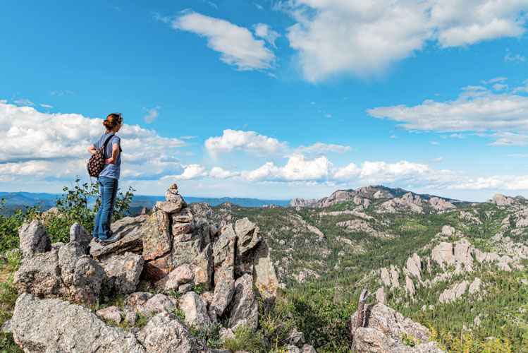
A combination of bike riding and hiking brought him to the top, where a steel fire tower provides rangers with an extensive view of the central Black Hills. “The closer you get to the central Hills, these mountains get a little more prominent, and there’s more elevation gain,” Sykora says. “You could see all the way north to Terry Peak, you could see Black Elk Peak, all the way into Wyoming.”
 |
Sylvan Peak
7,000 feet
Custer County
5 miles northeast of Custer
For the first time, Sykora strayed from his planned route. Instead of Medicine Mountain Road and Reno Gulch Road, he took Spring Creek Road, which wound through a peaceful canyon before meeting Highway 385 between Hill City and Custer. “I’d never been back there before. It was a deep canyon, perfect gravel road, little bit of a tailwind. It was a perfect time of the day and I felt really good there. I was flying and felt really strong.”
Traffic along the highways and at Sylvan Lake was busy with tourists, but few people make the hike up Sylvan Peak. Though it’s only about a mile and half to the summit, there is no dedicated trail and downed timber is strewn all over the hillside. “It was constant hopping from dead tree to dead tree to rocks. It was really hard because there was no smooth trail or even a meadow to walk in. It was just pure downed timber.”
Another false summit tricked him momentarily, but he found his way to the true peak, which offered a view of the backside of Crazy Horse Monument, Black Elk Peak (just 4 miles to the east) and Terry Peak.
 |
Black Elk Peak
7,242 feet
Pennington County
5 miles southeast of Hill City
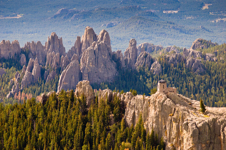
It may seem counterintuitive to leave the highest mountain in the Black Hills until last, but Black Elk Peak may be the easiest climb of the eight. A well-worn and fairly simple path leads hundreds of hikers every year from the trailhead at Sylvan Lake to the stone fire lookout tower built by Civilian Conservation Corps workers in 1939. For decades, South Dakota’s highest spot was called Harney Peak for Gen. William Harney, a military commander stationed in the Black Hills in the 1870s. The U.S. Board on Geographic Names approved the change to Black Elk Peak in 2016, to honor Lakota holy man Black Elk, whose vision quest to the mountain’s summit was recounted in John Neihardt’s Black Elk Speaks.
Sykora says he had planned to run the trail but hiked instead. An IT band issue had been causing him some pain in his leg. But after climbing seven of the Black Hills’ eight highest peaks already, he was due a more leisurely stroll.
Editor’s Note: This story is revised from the September/October 2020 issue of South Dakota Magazine. To order a copy or to subscribe, call (800) 456-5117.




Comments