The Gift of South Dakota
Subscriptions to South Dakota Magazine make great gifts!
Subscribe today — 1 year (6 issues) is just $29!
The Island Mesa
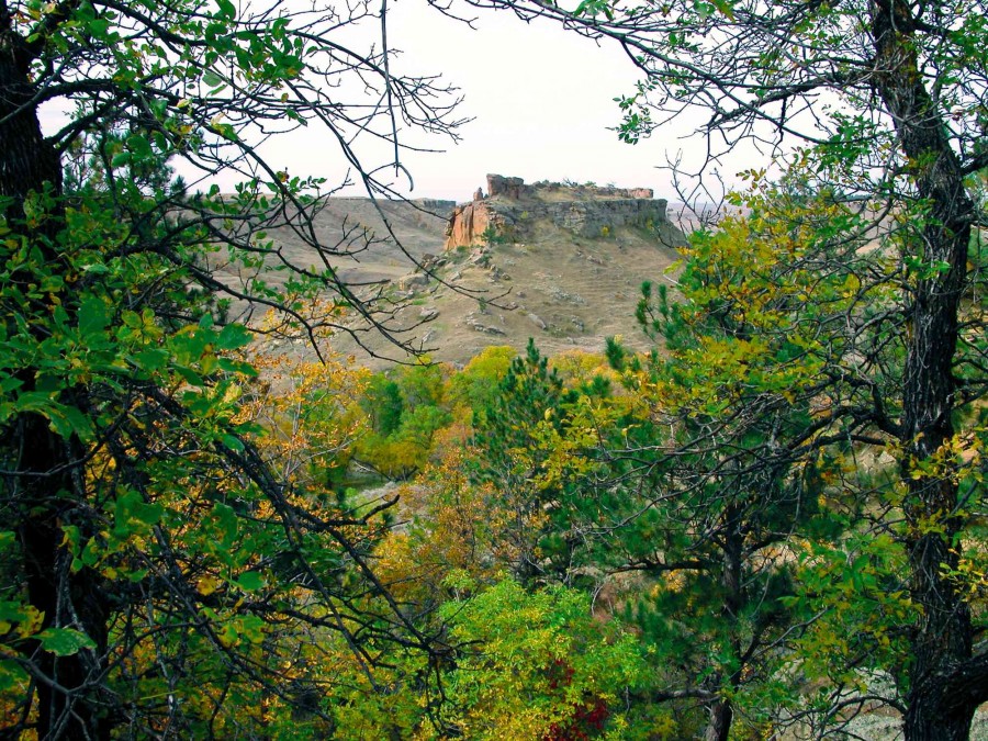 |
| The Island, an isolated mesa near Harding County’s Northern Cave Hills, has drawn explorers for centuries. |
The empty mesas of Harding County’s Cave Hills haunt me when I’m away. So I’m glad to be back on this autumn morning just after sunrise with a cold breeze descending from the northwest, hinting at snows to come.
I’ve brought a friend, Tim Herrmann, from the Oregon Coast. We plan to find an isolated mesa that local people call “the Island.” Girdled by 60-foot cliffs and standing uniquely alone in a larger canyon, the Island has attracted people’s attention for thousands of years and its cliffs are full of ancient rock art. Supposedly, only at a single spot hidden from view can one ascend to the Island’s top via a giant staircase of tumbled boulders.
After sunrise, my car bumps along two ruts northward from the small town of Buffalo into Custer National Forest. The ragged track gradually roughens and finally we see a small sign pointing to Davis Draw. Wary of high-centering and ripping out my oil pan, I park near a stock dam on the rolling plain half a mile from the draw’s mouth. Tim and I carry long hiking sticks because we were warned in Buffalo that prairie rattlers are especially thick this year.
We hike a rutted trace toward Davis Draw, its mouth gradually widening before us in the gap between two massive, vertical cliffs. Tim breaks our silence, asking, “What’s that?” and points to the southern cliff where a lone sentinel stands. It’s a “stone Johnnie,” or large rock cairn erected long ago by a bored hunter or herder. Far above us, corrugations of cirrocumulus pale from magenta toward white as the sun climbs above Slim Buttes to our southeast. On such a morning as this, under a mackerel sky, all good things seem possible.
I first heard about the Island several years ago while working as a volunteer with Assistant State Archaeologist Mike Fosha and others at a 6,500-year-old bison kill site west of Buffalo. Mike told me about a mesa in the Northern Cave Hills that was inhabited by spirits. He caged his words humorously, but meant them: “Some day before I die I’m going to take my sleeping bag and a bottle of tequila and spend a night on top of the Island, just to see what — or who — shows up.”
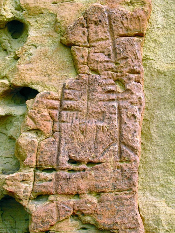 |
| While exploring The Island, Randall and Herrmann found glyphs scratched into stone by ancient hunters and gatherers. |
Many long-departed human souls have trod this canyon on hundreds of thousands of mornings like this, hunting antelope, deer and buffalo, gathering plant materials, looking for shelter, casting anxious eyes northward, concerned about the coming cold. For millennia, solitary hunters rediscovered the lonely mesa that stands as an island cathedral.
As we proceed higher into Davis Draw, its sandstone heights loom high and broad beyond us. Steep talus slopes, around or over which we must pass, hide the canyon’s farthest reaches. Ash, cottonwood and oak splashed with autumn’s oranges and yellows adorn the small coulees and hidden ravines that drain the surrounding cliffs. Across the canyon, three pronghorns graze by a dry watercourse, occasionally glancing up to monitor us.
Harding County residents gave me directions to the Island but the descriptions are vague, for it stands far back in the canyon. Many red-brown cliffs precede it, reaching out deceivingly and hinting that they stand apart from the main Cave Hills butte. But after a laborious approach that gains us a better view, we see them for what they are: hoaxers that twist away into box canyons where they connect to the main Cave Hills landform. The sandstone mesas that comprise these Cave Hills stand 300 to 500 feet above the surrounding prairie. Their tables are eroded remnants of a larger strata that covered this entire region 55 or 60 million years ago during the Paleocene epoch. These vibrant scarps dramatically overlay the sober gray and brown hues of the older Hell Creek Formation, which bristles with fossilized dinosaur bones.
We squint at a massive set of escarpments far back in the canyon, perhaps a mile or more away, distances being deceiving. What seems close at hand through the crystalline air is really much farther. Tim says, “You think those cliffs are the Island?”
We can’t tell so we cross the draw to a higher slope to gain a better vantage point. We leave behind a web of cattle trails that lace the lower slopes and thrash our way noisily uphill around car-sized boulders and clumps of prickly pear, dodging still-ripening patches of sand burrs. Our noise is purposeful for we don’t wish to surprise any cranky snakes. Tim comments that we haven’t seen a single one, and I wonder aloud, “Well, we’re just day-tripping outsiders. Maybe we’ve been kidded a bit.”
Finally we reach a point high enough that we see in the distance yellow cottonwoods and green-black pines populating a small declivity that has been eroded. This partial view of the region behind the cliffs implies we are looking at our destination, the Island. Three turkey vultures circle above it on thermals rising from the land.
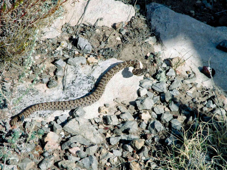 |
| They nearly stumbled upon a prairie rattler sunning itself on a warm rock. |
Half an hour later we find we’re wrong. We struggle up a steep talus slope toward the cliffs and realize it will take us much longer to work our way around them to a point where we can see if they are attached to the main Cave Hills mesa, so we look for a closer spot where one of us can boost the other to the cliff top and clarify the matter. Shortly, we find a low slot. I boost Tim’s foot and he hoists himself over a 6-foot ledge to the top. He finds that the mesa is part of the main, not the Island.
Tired and a bit discouraged, we stop to reconnoiter. To the south we see another prominent set of cliffs. Though we cannot be certain, it seems those vertical walls may front a mesa that stands apart from the Cave Hills. We decide to hike across the canyon and climb the talus that for millions of years has calved from those seemingly-fragile cliffs.
Half an hour later we turn the southeast corner of the cliffs and realize we’ve found our goal, our freestanding “Island.” And there beside us rises a wide rock panel that gradually fills us with a sense of wonder. Incised in rough sandstone walls are many etchings: a bison head shield, an antelope, many overlapping petroglyphs of small animals, a deer, a warrior and spear, a warrior on horseback. And beyond these are incised a set of deeply scarred, elaborate forms that look truly ancient. How old could they be, and what do they depict? We cannot tell, for a portion of that glyph has disappeared long ago, fallen into the canyon through the work of wind and weather.
We separate and search in opposite directions for a pathway to the top. After only a few minutes of exploring I find the jumble of car-sized boulders that will allow us access to the summit. Tim rejoins me and we ascend easily.
The Island is shaped like an old galleon, with massive formations of contorted, pink sandstone rising at its bow and stern. Its eroded midsection is a mat of dried grasses, littered with several gray, fallen skeletons of wind-twisted pines. We stand in silence for a time, gazing west at the far mouth of Davis Draw through which we came over two hours earlier, and at the plains beyond, toward Montana on the horizon.
We separate and explore the high sandstone features at each end, skirting the vertical cliffs that drop away on all sides. As I rejoin Tim, he suddenly glances down, pointing, “Hey, look at him.” Planted firmly in its coil, a young prairie rattler shakes its tail at us from four feet away. Some folks understandably would kill it. But Tim and I simply stand there and watch as the snake warns us for a moment, then slowly uncoils. Holding its head high, it watches us as it retreats onto a massive flat rock near the cliff’s edge 15 feet away.
Bemused, Tim says, “How’d that guy get all the way up here?”
“Its ancestors probably came up the same way we did, though it must not have been easy,” I reply.
Suddenly, the retreating snake, still watching us, flips awkwardly, belly up, and falls sideways into a vertical rock crevice, wedging into the darkness an unknowable distance below. It may sound foolish, but I felt a sudden sense of loss. The young snake, eager to escape, watched us rather than where it was going, making a possibly fatal mistake.
Tim shakes his head. “Somebody’s gonna wonder why he’s late for dinner.”
We glance around to make sure no other members of the same family are present, then take a seat. We pull out water bottles, trail mix, apples. A zephyr of refreshingly cool air brings the pungent scent of sage and pine pitch, and melodic hints of distant birdsong. Across the canyon on the main Cave Hills mesa’s twisted cliffs lie remnants of the same pink sandstone that stands near us. It’s so eroded and contorted by great pressures and stresses over so many eons that only an imperturbably patient God could have witnessed it, a God who loves a story in a slowly unfolding world.
After a while, Tim and I slowly gather our stuff. We look around a last time, not wanting to leave this wild cathedral. A sudden breeze of cooler air reminds me that another autumn soon will end, and this Island mesa will fall into silent stillness. Cold winds will drift snow across this empty height, hiss against these cliffs, fill the snake’s crevice. And who will be there to see it? The snow will sift into badger holes and coulees, settle on the talus slopes and fallen boulders. It will silence the rattling wheatgrass, greasewood and phlox, and smother the bleached bones of the dead.
EDITOR'S NOTE: This story is revised from the September/October 2009 issue of South Dakota Magazine. To order a copy or to subscribe, call 800-456-5117.





Comments