Hi there, we've noticed you are using a computer with an outdated browser and/or operating system that does not allow for secure online shopping. Please call South Dakota Magazine at 800-456-5117 to place your order by phone or if you have any further questions. We apologize for the inconvenience.
- Heidi Marsh, Marketing Director
South Dakota Magazine, Yankton, SD
Beautiful Buttes
Oct 13, 2015
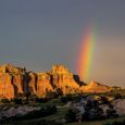
Slim Buttes is a mix of badlands, ponderosa pine forest and mesas surrounded by West River grasslands. It runs 40 miles north-to-south and is just 20 miles wide. Most travelers only see the buttes as they climb the high hill east of Buffalo on Highway 20. Looming south of the highway are the Castles, twin white buttes that look like royal ruins. Most of the other peaks and promontories have names, too. Ranchers dubbed one formation The Seals, and another Three sisters. Official names include Doc Hodge Draw, Adam and Eve Butte, Battleship Rock and Government Rock, the highest point. Photos by
Christian Begeman.
The Cave Hills rise from the plains north of Buffalo in Harding County. Photos by Christian Begeman.
Fall is in full swing in South Dakota and farmers across the state are hard at work in the fields.
Custer State Park includes a landscape perhaps more diverse than any other in the state or region. ...
Slim Buttes is a mix of badlands, ponderosa pine forest and mesas surrounded by West River grasslands. ...
Bonny Fleming, Rapid City, shared these tranquil photos from along China Gulch Road near Hill City.







Comments