Posted on Leave a comment

Quiet, Beauty and Snow

“How does it feel,” my companion asked as he sipped coffee at dawn, “to be perched on the edge between heaven and earth?”

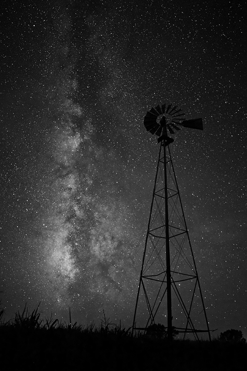
The assessment seemed right, for several reasons. The most immediate was our sunrise breakfast on a high-pitched ledge of rock on the eastern slopes of the Black Hills. There was fire in the sky that morning as the flaming sun rolled over the dim horizon, as the lower sky broke into a radiant orange, as the last of the morning stars glimmered in the cobalt-blue expanse of the infinite overhead.

We had spent the night on the shelves of this cliff some 6,000 feet up, and there wasn’t much between us and the towering South Dakota sky. Harney Peak, which at 7,242 feet is the highest point east of the Rockies, was an over-the-shoulder glance behind us. We could survey bony outcroppings of granite thousands of feet below. The world had been laid at our feet.

But the sense of being poised between heaven and earth had as much to do with the character of this landscape — the Black Elk Wilderness Area — as it did with our aerie lookout to watch the turning of the celestial orbs. Some say the place is sacred. The Black Elk Wilderness Area is at the heart of the Black Hills which were held in holy trust by the Native Americans who lived for thousands of years on the plains surrounding them. Not only did the area provide an abundance of needed game, plant life and seasonal refuge, but it was also believed to be an especially sacred area.

It was a place for seeking visions — often at the summit of Harney Peak, known in various Plains Indian dialects as the “tall rock mountain at the center of the world.” Now comprising over 13,000 acres of undeveloped national forest land, the area was named in 1980 for the Lakota holy man whose life story is chronicled in John Neihardt’s classic Black Elk Speaks.

The feeling that these woods, these rocks, these meadows are special persists today. Even those who are less romantic, less sentimental about the natural landscape will admit sensing something different here. Others will tell you the preserve (like Bear Butte to the north or the Stone Medicine Wheel in Wyoming’s nearby Big Horns) is among the world’s sacred spots. Those who are inclined toward the mystical may report extraordinary soundings in these woods, and earnest New Agers appreciate the sense of place and point to the glittering mica and quartz crystal found here.

Of course, my companion and I did not hold such lofty views a few mornings prior to that luminous dawn watch. We had awakened to snow. Maybe three inches. Startling our stockinged feet. Draped generously on our tent. Blanketing our metal cook gear.

This was not our first trip to the Black Elk area in late fall or early winter, and each time we had just missed heavy snowfalls. Feeling either lucky or blessed we kept coming back, largely because we like the Hills this time of year. The temperatures are brisk but pleasant and the place is mostly empty.

One of the main advantages of this wilderness area is its accessibility: the highest reaches are but a day’s hike from the car. An elaborate trail system networks the wilderness area with the surrounding forest lands as well as Mount Rushmore, Custer State Park and Wind Cave National Park. It also splices into the Centennial Trail which runs the length of the Black Hills from north to south.

But the accessibility is also one of the area’s biggest drawbacks: backcountry backpacking and solitude can be quickly undercut by trooping vacationers, picnickers and day hikers. Even Harney Peak’s summit, capped with a stone lookout tower built in 1938 but no longer used, is an afternoon’s jaunt from a parking lot. So we come in autumn and take our chances with shifting winds, and waking occasionally to ice in our water bottles.

And there we were now, waking to a snow-laden landscape after star-gazing the night before. So we cooked breakfast in the cold, wet snow and ate in the snow and took our tent down in the snow and hiked all morning in the snow — in a grey and white wonderland of pine, birch and oak, and big, heavy flakes, under a low-hanging sky of slate-grey.

But by early afternoon the beauty and novelty weren’t enough to offset the soggy boots and numbing toes, and a closing-in sense of foreboding. After a chilly lunch, we stood in a bitter wind and looked at the cold, grey day and kicked at the three-inch snow as if it would tell us how long the storm would last.

There are no weather reports in the woods and not much sky when you’re hiking the shoulders and ravines of precipitous forestland. We didn’t know what to do — head for cover or carry on?

But before we had to choose between foolhardy courage and cowardly caution, a patch of white clouds appeared. Then a window of blue sky. Then a puddle of sunlight. And by midafternoon the storm had passed through and the sky was clear and the sunset was brilliant.

We set up camp that evening in a gold grass meadow, laid out our sleeping bags to dry, and scrambled up some rocks for a cocktail hour of Gatorade and trail mix. The vista was stunning — red sun sinking in the west, full white moon rising over rocky peaks in the east. Luminescent.

I like being in a place where I am not confined to campgrounds, but am left to my own allegiance to low-impact camping. I like to get off the trail and explore a bit, whether it’s struggling to the top of Little Devil’s Tower, finding a perch to admire Cathedral Spires, or climbing around on the huge slabs of granite scattered about the area.

One of my favorite features of the Black Elk Wilderness are the rock formations — giant boulders and splintery crags, projectile needles and weathered knobs. They will make you stop and stare. And think. These fingers and fists emerged from a seabed as a great dome of molten rock plunged through and transformed the layers of limestone and sandstone sediments laid down 600 to 700 million years ago. Erosion and weathering have left the granite pegmatite exposed and gnarly and wondrous. But then I favor rocks.

There is also a fair amount of wildlife here — ground mammals, deer, wild turkey, beaver, an occasional elk or bobcat or mountain goat, bald and golden eagles. But the main attraction, it seems to me, is something which comes through the soles of the feet when you have hiked here awhile, or through the pores when you least expect it. It is an awareness that there is more here than might be detected through our meager senses — something luminous, something of the heart of the place, something which puts you in touch with both the earth and sky.

Editor’s Note: Kerry Temple lives in South Bend, Indiana, where he is editor of Notre Dame Magazine. This story originally appeared in the November/December 1992 issue of South Dakota Magazine. To order a copy or to subscribe, call 800-456-5117.


Posted on Leave a comment

Custer’s Four Seasons

Custer State Park in the southwestern Black Hills is a place of superlatives. South Dakota’s first and largest state park boasts one of the largest publicly-held herds of wild American Bison in the world. The scenery is also some of the best you will find in our state. Thickly forested heights in the north give way to windswept prairie valleys in the south, providing a unique crossroad of geography as well as ecology.

I’ve spent as much time as I could in the park the last few years. Although I love the high country that includes scenic Needles Highway and Sylvan Lake, my favorite part of the park is in the southeastern half among the grassy valleys and prairie hills. I especially love the interior gravel roads that crisscross between points northeast and southwest along the wildlife loop road. I’m a sucker for wildlife photos. The wildlife loop is our state’s version of the Serengeti with all the wildlife that can be seen outside the car window.

My ultimate goal is to get shots of a wild mountain lion. I haven’t seen one yet. A couple summers ago, I thought I hit the jackpot. About dusk driving north on Highway 87 from Wind Cave National Park I rounded a bend in the road and saw the shape of a large feline casually strolling across the road. I hit the brakes and grabbed my camera. By the time I got my prize in the viewfinder I was only able see his rear end disappearing into the pines. I also noticed the tail was bobbed and the ears were pointed. So what I saw was not a mountain lion, but probably a very large bobcat or maybe a Canadian Lynx (if there are any of those roaming the Black Hills). Not my goal, but the rush of seeing the cat was exhilarating.

It’s that kind of adrenaline that drives me to cruise the back roads of the park in evenings and early morning. I’ve also learned the hard way that I need to stay on those roads. On Memorial Day weekend of 2010, an unseen rock punched a hole in my oil pan when I made a turn on what I thought was flat ground in the Fisherman Flats area. Dumb move. Thankfully I had enough cell coverage to reach the park headquarters and even more thankfully, the park ranger was a nice guy with good stories to tell as we waited for a tow truck to arrive from Custer. I’m sure I was now on his list of”things boneheads from East River do” stories. Oh well. Because I was without a vehicle the next day I hiked all around Stockade Lake and found my first shooting-star flowers high up along the trail.

Up until this September, I had visited the park in every season except fall. This time around, I was able to spend a couple days cruising the park as the fall colors were reaching their prime. Vibrant reds, yellows and oranges along the creek beds and canyon floors accented the already scenic views. My main goal was to shoot some of the wildlife amongst the autumn colors. With the abundance of wildlife used to vehicle traffic in the park, this goal wasn’t as challenging as I thought it might be. I was able to get bison, pronghorn and deer all with fall colors in the shots.

My last morning in the park, I drove up Needles Highway and waited for the clouds to clear so the early sunlight would hit the cathedral spires. While I waited, I heard a few weird calls in the valley below and then noises of wildlife scrambling in the rocks and then away and out of earshot. My mind imagined a mountain lion pursuing an elk or deer, but I really don’t know what it was. Soon the sun came out from behind the morning clouds and I got my photo. It was a good end to another successful stay in Custer State Park. Any time I have a chance to visit the granddaddy of all South Dakota state parks, I do. It is truly a priceless treasure nestled within our great state. I’ll be back…but not soon enough.

Christian Begeman grew up in Isabel and now lives in Sioux Falls. When he’s not working at Midcontinent Communications he is often on the road photographing our prettiest spots around the state. Follow Begeman on his blog. To view Christian’s columns on other South Dakota state parks and recreation areas, visit his state parks page.


Posted on Leave a comment

Nature’s Buglers

Editor’s Note: This story originally appeared in the Sept/Oct 2010 issue of South Dakota Magazine. To order a copy or to subscribe, call 800-456-5117.

Listen closely while in the Black Hills in September. Fall is the rut for South Dakota’s elk herd, and as they shed the velvet from their massive antlers, bulls will be bugling for cows. One of the most distinctive sounds in nature, the call begins low and resonant, then rises to a high-pitched squeal.

South Dakota’s elk population has recovered from the brink of extinction to become the largest in the country east of the Rocky Mountains. When Lewis and Clark paddled up the Missouri River 200 years ago, elk were so abundant that one of the first places they camped in present day South Dakota was known as Elk Point. The heavily wooded site was a runway for elk traveling between the Missouri and Big Sioux Rivers. But by 1900 hunters had thinned the American elk population from 10 milion to less than 100,000.

Rocky Mountain elk were captured and used to replenish herds. According to the South Dakota Game, Fish & Parks site, about 4,000 elk roam the Black Hills National Forest and the grasslands of Butte, Bennett and Gregory counties. A herd has also been established on the Lower Brule Reservation north of Chamberlain.

Posted on Leave a comment

Black Hills, Mining, Land and the Lakota

I hear cries in the occupied wilderness this week.

The Lawrence County Commission met in Deadwood today to consider Valentine Mining’s application to dig for gold in Spearfish Canyon. Some Black Hills locals spoke in favor. Some spoke against. All were white folks.

After three hours, an Oglala Sioux woman, Charmaine White Face, took the microphone. She urged the commission not to approve the permit. Among other reasons, White Face questioned the authority of any white person in the room to approve this mine. She read back to us President Grant’s 1875 order to the Army to stop blocking miners from entering the Black Hills, the effective abrogation of the 1868 Fort Laramie Treaty. This treaty violation, said White Face, means no white person really owns any part of the Black Hills. No white commission can exercise any sovereignty over this stolen land.

The organization leading the fight against the 21st century miners calls itself the Spearfish Canyon Owners Association. Owners. Perhaps I project, but White Face’s white allies in the room seemed to remain uncomfortably silent through her talk.

Meanwhile, an hour to the south, some of White Face’s compatriots want to buy 2000 acres of grassland in the heart of the Black Hills. The Lakota call this place Pe’ Sla; we call it Reynolds Prairie. Pe’ Sla is as sacred to the Great Sioux Nation as Bear Butte, Harney Peak and Devil’s Tower. It goes up for auction Saturday.

“The Black Hills are not for sale,” the Sioux declared in 1980 when they refused a hundred-million-dollar settlement of their demand for the return of the Black Hills. But the Black Hills are for sale, say the white owners of Reynolds Prairie. To save Pe’ Sla from the sacrilege of subdivision, tribal activists are raising money to bid in Saturday’s auction and take back their country by the white man’s rules of gold and green.

In Deadwood, a Native woman says we whites cannot own, let alone mine, the Black Hills. Just down the road, Lakota people believe that, to protect the holy land, they must buy that which is not for sale from those who do not own it.

We cannot speak of the Black Hills without contradiction.

Cory Allen Heidelberger writes the Madville Times political blog. He grew up on the shores of Lake Herman. He studied math and history at SDSU and information systems at DSU, and is currently teaching French at Spearfish High School. A longtime country dweller, Cory is enjoying “urban” living with his family in Spearfish.

Posted on Leave a comment

Trees Don’t Pay Taxes

If I had to list the many blessings that I enjoy as a citizen of these United States, national and state parks would rank high on that list. I fell in love with the Ozark National Forest when I was a teenager and I continue to visit Gunner Pool Recreation Area nearly every year. This is a deep canyon cut by Sylamore Creek, a clear, trout-laden stream coursing around moss-encrusted stones the size of houses.

Shortly after I set down roots in South Dakota, I discovered the Black Hills and the Badlands. Several years ago two of my NSU colleagues and I went backpacking in Wind Cave National Park. While walking across a vast field of grass a foot and a half tall, Professor Dias tripped over a railroad spike that someone had driven into the ground years before. It was a moment of great wonder. How had he managed to find that spike in all that grass? Perhaps the Creator Himself had placed it there, as a little joke for me and my friends to enjoy.

I have returned to that spot many times, first with my daughter and later with my son. You can visit prairie dog towns, dodge buffalo, weave your backpack through stands of old trees, and sleep to the sounds of elk rutting. I have seen a herd of antelope that all seemed be allergic to the ground, a committee of wild turkeys voting on which way to collectively wobble, and a rattlesnake whose patience with hikers had very nearly run out.

Custer State Park offers similar charms. The Black Hills are like a chunk of material that fell off the back of God’s flatbed truck when he was on his way to landscape the Rocky Mountains. I have raced my children to the stone house atop Harney Peak twice, several years apart. I won the first race but lost the second. At Sylvan Lake I watched a couple of adventurers rock climbing on the wall of the lake. They were climbing the outside of the wall, not the inside.

All of this came to mind when I read that California may have to close seventy state parks. Bears, wolves, and redwoods are all beautiful, but it is very difficult to persuade them to pay taxes. That’s unfortunate, because California is sunk in a fiscal tar pit up to its stately breastbone.

When economies are growing, state revenues increase. Politics is then largely about who gets how much of the next chunk of cash. When growth stalls, it’s about who and what survives the next round of cuts. It also matters how well a state manages its finances. California is dreadfully mismanaged. South Dakota, by contrast, is well-managed, which is why we aren’t worrying right now about closing Custer State Park or perhaps renaming it after a cell phone company. Talking about how precious our parks are won’t save them. Saving them requires fiscal responsibility.

Dr. Ken Blanchard is a professor of Political Science at Northern State University and writes for the Aberdeen American News and the blog South Dakota Politics.

Posted on Leave a comment

Friendship Tower

When my husband and I visited Mount Moriah Cemetery in Deadwood last summer, we climbed the steep path to Seth Bullock’s plot facing Mount Roosevelt. I found the story of his grave intriguing. Bullock met Theodore Roosevelt during Roosevelt’s years on a North Dakota ranch. The two remained friends during his presidency and Roosevelt appointed Bullock U.S. Marshall. Shortly after Roosevelt’s death in 1919, Bullock and the Society of the Black Hills Pioneers built Friendship Tower on the mount as a memorial to his friend. Bullock died a few months after the tower dedication and, at his request, was buried 750 feet above the main portion of the cemetery with a view of Mount Roosevelt across the gulch.

Jeremy and I were in Deadwood again a few weeks ago and looking for an easy hike when we remembered Mount Roosevelt. There aren’t a lot of signs promoting its trail, but it is easy to find. You head north a little ways out of Deadwood on Highway 85, take a left on Mount Roosevelt Road and follow it for about 2 Ω miles until you reach the trailhead/parking lot. Josh from howtoenjoytheblackhills.com has even posted a video showing the route.

A well-maintained picnic area marks the trailhead to the castle-like tower. We hiked the half-mile path through oak and pine, skirting scree slopes and boulders. Raspberries even ripen along the trail in season. The trail and 31-foot tower atop the 5,690-foot summit are maintained by the Black Hills National Forest. New stone steps on the outside of the tower and a steep spiral staircase on the inside were added to allow an expansive view. There is also a little viewing deck just northwest of the tower for those who don’t want to scale the stairs.

It’s not strenuous, but I highly recommend this hike if you want to stretch your legs during a day in Deadwood. Bullock chose the location for its overlook of the plains beyond Belle Fourche and on into North Dakota where Roosevelt had his ranch. We could also just make out Bear Butte and Harney Peak. It’s cheap entertainment for your visit to the gambling town!

Posted on Leave a comment

Flying Wheels

Semi-regular South Dakota Magazine photo contributor Jeremiah M. Murphy took photos of skateboarders at the first of this summer’s three Black Hills Skateboard Comp Series events at the Rapid City Skate Park. The next competition in the series will be July 14. Technical information on the stunts in these shots was provided by Nick Wittman and the crew at Gnar Spot in Rapid City. View more of Murphy’s photos at Tumblr.

Posted on Leave a comment

Art Alley 2012

Art Alley was started in downtown Rapid City, between Main Street and Saint Joseph from 6th to 7th Street, in 2005. Todd Rigione and other Black Hills artists were painting the walls inside the Presidential Building when they ran out of space. Rigione suggested they continue outside. The art has evolved and changed greatly through the years since. Rebecca Johnson took these photos the first weekend in June.